What can geomarketeer do
Features
Visualize, analyze, edit, interpret, and export data to unmask hidden trends and patterns
Data Library
Interactive Maps
Data Querying
Reporting
Data Library
Pan-India data at micro-market granularity
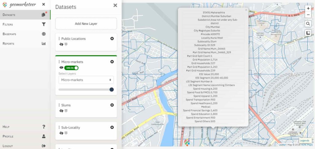
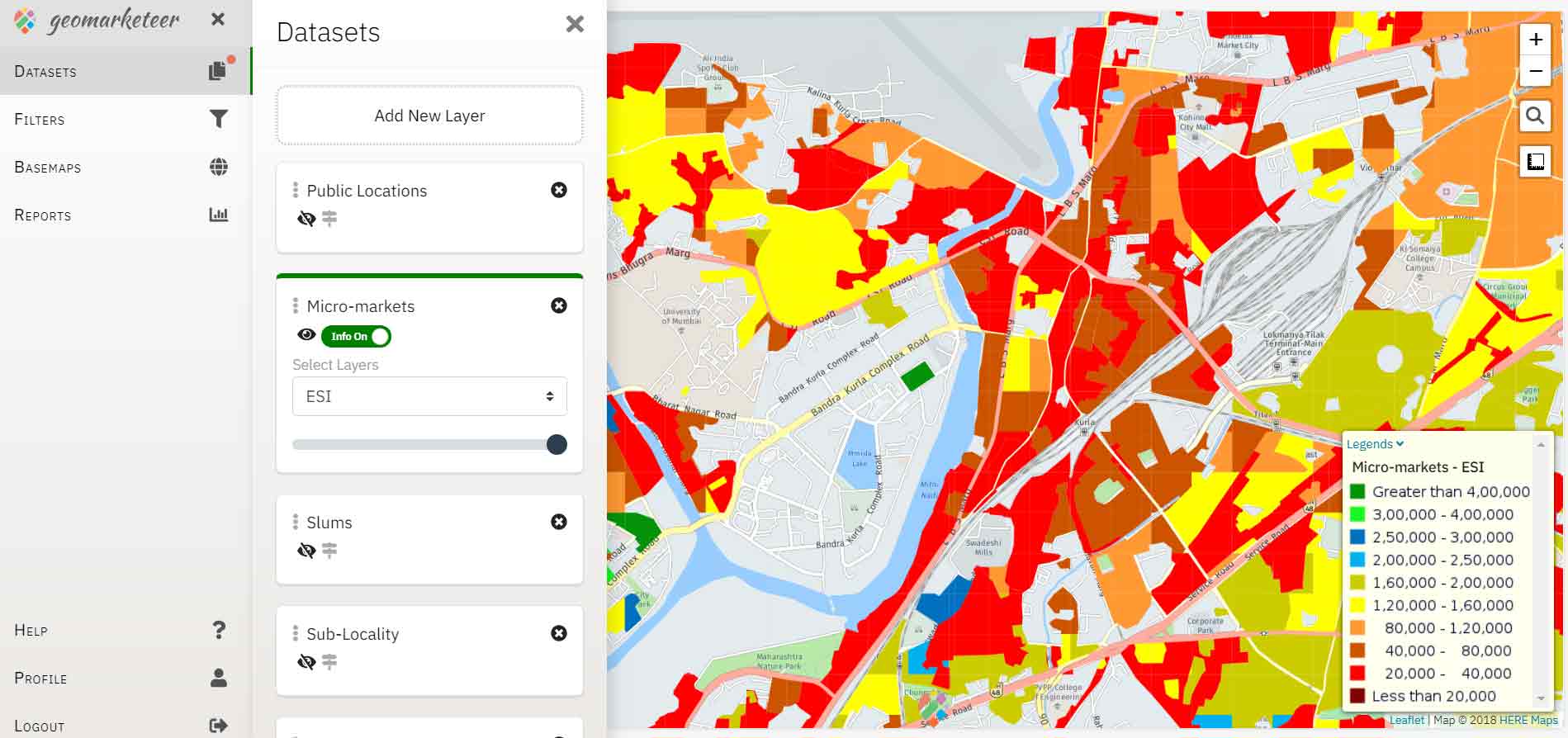
Geomarketeer’s pan-India data includes satellite and street basemaps, city extents, pincode boundaries, locality boundaries, slum pockets, cafes, malls and much more. This data is presented in thematic layers to enable ease of visualization and analysis. You can also import your own datasets for custom analytics.
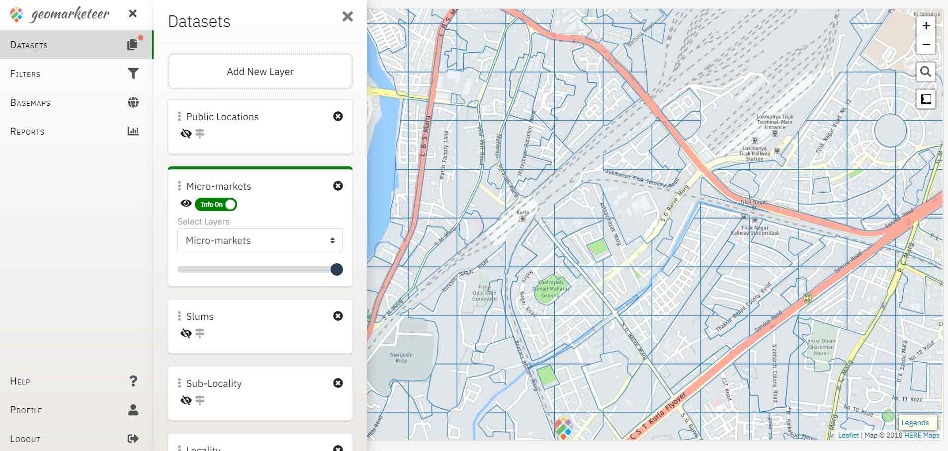
Interactive Maps
Go beyond simple street maps
Geomarketeer comes with a rich, interactive, and customizable mapping interface.
- Easy to navigate layer and data dashboard
- Map based location search
- Custom layers addition
- Thematic map layers and responsive legend
- On-click attribute information pop-up
- Multiple layer interaction
- Different basemap styles
- Area and distance measurements
Data Querying
View and analyze data according to your needs
Geomarketeer provides a multi-nested querying capability which allows users to focus on specific micro markets with potential for their brand. You can apply custom queries and filters on the micro market grids, to view and analyze the locations that meet your criteria.
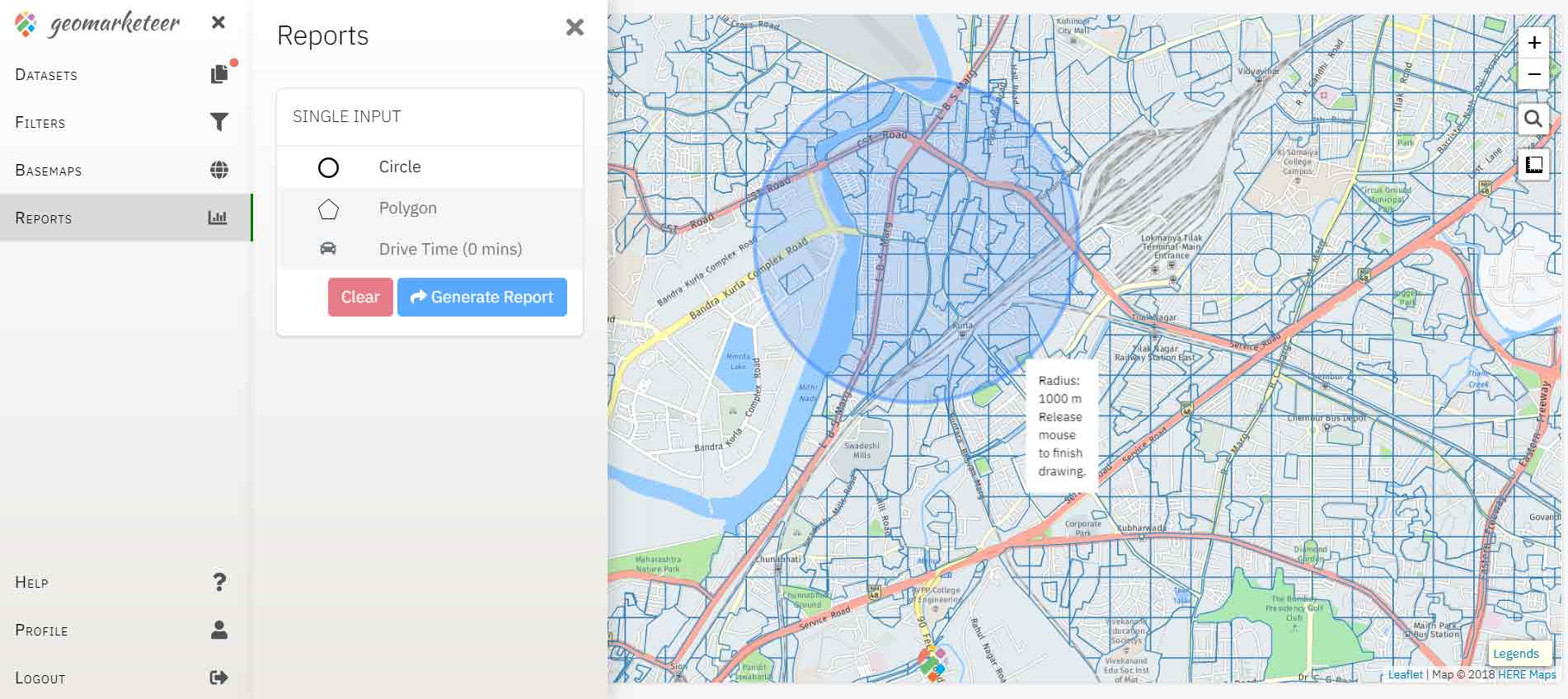
Reporting
Export customized reports for a deeper analysis
You can select a catchment using an array of drawing tools or generate a drivetime polygon. After selecting a catchment of interest, you can extract market and location information, and catchment analysis of the population, households, lifestyle affinity and expenditure indices.